Colder temps are making a return today in a big way. We’re going to go from above well average temperatures over the past few days and dive straight into weather that is more remiscent of January. FINALLY, it returns. This week has been a huge bummer but all that will be behind us soon. Check out the map of current temperatures over the Southeast below. You can see that frigid air is knocking on our door.
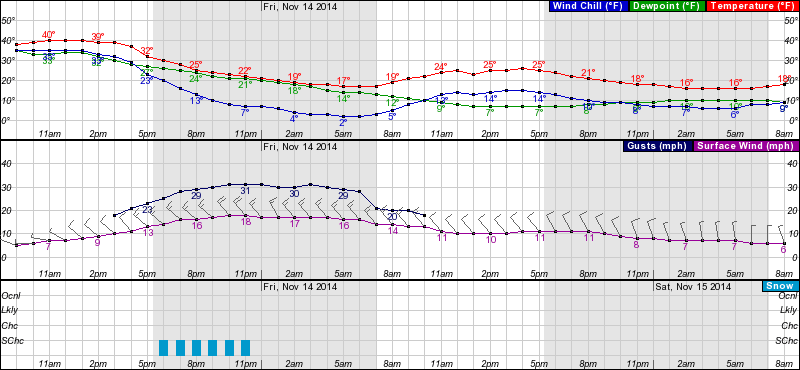
Once that colder air moves in today, we’re going to see Sugar and Cat make snow for an extended period of time. They’ll probably be able to make snow continuously through midday Saturday. Check out the forecast for Sugar below. Brrrr!
I’m getting cold just looking at those numbers in the teens.
36-48 hours of continuous snowmaking in well below freezing temps is just what the doctor ordered. Sugar and Cat both should be looking much better come Saturday. Additionally, I think we’ll see some other resorts fire up the snow guns in anticipation of an opening next weekend. It’s going to be cold across the entire region, so we could have snowmaking going on in Tennessee, Virginia, West Virginia, Maryland, and North Carolina by tomorrow morning. That would be awesome if everyone is able to make snow tonight. I might do a video post tomorrow and do a round up of all of the ski cams, which you can find HERE by the way.
Things are about to get going for good I do believe. The weather forecast looks awesome (minus some undeveloped snow Monday). The next week or so is going to be exciting as snowmaking resumes and we hear about opening dates and what not. I’m pumped. Bring it on.
Until tomorrow.


